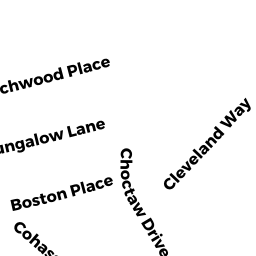
77 JEFFERSON SHS RD
Owner Information
BEDARD ALAN R
325 BENNETT ST
WRENTHAM, MA 02093


Property Details
77 JEFFERSON SHS RD is classified as a Single Family Residential (Cape cod).
The primary structure on this property was built in 1940. There are 6,038ft2 of built area within this property. There is 2,260ft2 of residential/living space within this property. This property is listed as having 8 rooms.
77 JEFFERSON SHS RD is valued at $598,100. The land is valued at $275,000 and the structures are valued at $323,100.
This property is in Zone R30. Confirm with local Zoning Board authorities to ensure there are no overlays or other easements on this property.
The most recent deed for 77 JEFFERSON SHS RD is recorded at the local registrar in Book 24625, Page 0120. 77 JEFFERSON SHS RD was last sold on Friday, March 28, 2003 for $585,000.
Assessment data from fiscal year 2022.
Flood Data
This property is partially within the VE Zone (coastal flooding with wave action). Approximately 0.08 acres (30.88%) of the property is within this zone.
The base flood elevation for this flood zone is 21 feet.
This information is sourced from the FEMA National Flood Hazard Layer. See our full disclamer.
Broadband Internet Providers
| Provider | Type | Bandwidth (mbps) | |
|---|---|---|---|
| Verizon New England Inc. | DSL | 3 | 0 |
| Viasat Inc | Satellite | 35 | 3 |
| Comcast | Cable | 1000 | 35 |
| GCI Communication Corp. | Satellite | 0 | 0 |
| HughesNet | Satellite | 25 | 3 |
| VSAT Systems, LLC. | Satellite | 2 | 1 |
| Verizon New England Inc. | Fiber | 940 | 880 |
Broadband service provider data from December 2020.
Adjacent Properties
- 0 TERRY LN
Improved, Selectmen or City Council (Municipal) owned by TOWN OF WAREHAM - 0 FONSECA WY
Undevelopable Residential Land owned by CORNERSTONE ESTATES 2 - 0 JEFFERSON SHS RD OFF
Undevelopable Residential Land owned by JEFFERSON SHORES ASSOC INC - 71 JEFFERSON SHS RD
Single Family Residential owned by SWEETMAN ARTHUR L